Hualien County is the largest county in Taiwan and is located on the mountainous eastern coast of Taiwan.
Hualien was also known as Kilai(奇萊) by aborigines, "Turumoan"(多羅滿) by the Spanish who came for sand gold, Huilan"(洄瀾) by the Chinese and then finally Hualien by the Japanese.
We came to know from Mr Lu that Taiwan was also once ruled by the Japanese which explains why most websites have a Japanese language version.
The difference was that the Japanese made major contributions to Taiwan instead of squeezing them dry.
The tunnels, dam and hydro power generator which are currently still in use are some examples of Japanese built remnants.

The Liwu River behind me is dry as there was no typhoon recently (woohoo).


The entrance to the Central Cross-Island Highway.
Basically, Taroko Gorge is the central mountain range of Taiwan and one of the 7 national parks of
Taiwan.It spans the counties of Hualien, Taichung, and Nantou.
Taroko, means the "magnificent and beautiful" in the language of the local Truku aboriginal tribe.

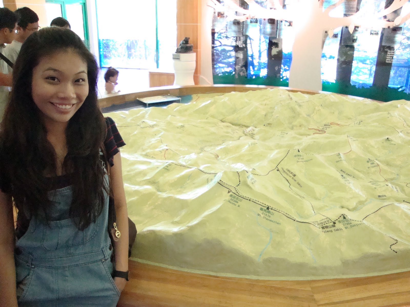
Headed to the Taroko National Park Visitor Center to find out more about the park.
There were many kids there!
Hopefully, their outdoor teaching method to the younger generation would payoff in maintaining the natural beauty in their country.

Our packed lunch which ranged from NT60 to NT80.

The basic box of half an egg, toufu and vege.
Yong's deep fried fish is in the seperate paper bag.

My chicken thigh lunch box which I could NOT finish!


Where we had lunch.
Look at the natural landscape that accompanied us during lunch.

Mr Lu's yellow taxi which he complained that although it was light in color, it still captured heat.
His 3rd wife was white simply to avoid capturing heat during summer.
After the lunch stop, we headed to the first pit stop in Taroko National Park.
Shakadang Trail 砂卡砀步道, also known as Mysterious Valley Trail 神秘谷.


The trail is on the right, in between the lush greenery if you can see from the above photo.
The whole trail can take up to 3 hours but we only did the 20 minute walk to one of the benches as you have to walk back the 20 minutes.

Requested by yours truly to show you how low the rocks are.

This was one part of the trail that was a like a pass.
There was a board saying that this pass was used by the aborigine to get to and fro places required.
Also, this pass was really windy.
It's like a wind passage way.


The lush greenery with the rocks and the bluish green water.

Think the heat got to my head..haha...

Still sane..


We rested at the benches and took some photo.
One might think it would be humid and hot in there but it was pretty windy.

The water bottle (多喝水) had a Sanrio character on it!
Very cute!

Heading back to the start of the trail.

The red bridge was the linkway to the entrance of the Shakadang trail.
Looks really impressive here.
What's more impressive is that there are about 100 marble chinese lions on the bridge.
And those lions have different expressions on them.
Really cute!


The chinese lions I mentioned.
So cute right?
Also, these are all made of marble!
Reason being that Taroko Gorge has it's own marble rocks and we saw plenty when we were there.
Since it's a nature reserve, we can't take it out =P

See how long the bridge was?
This ends the Shakadang Trail bit at Taroko.
No comments:
Post a Comment